
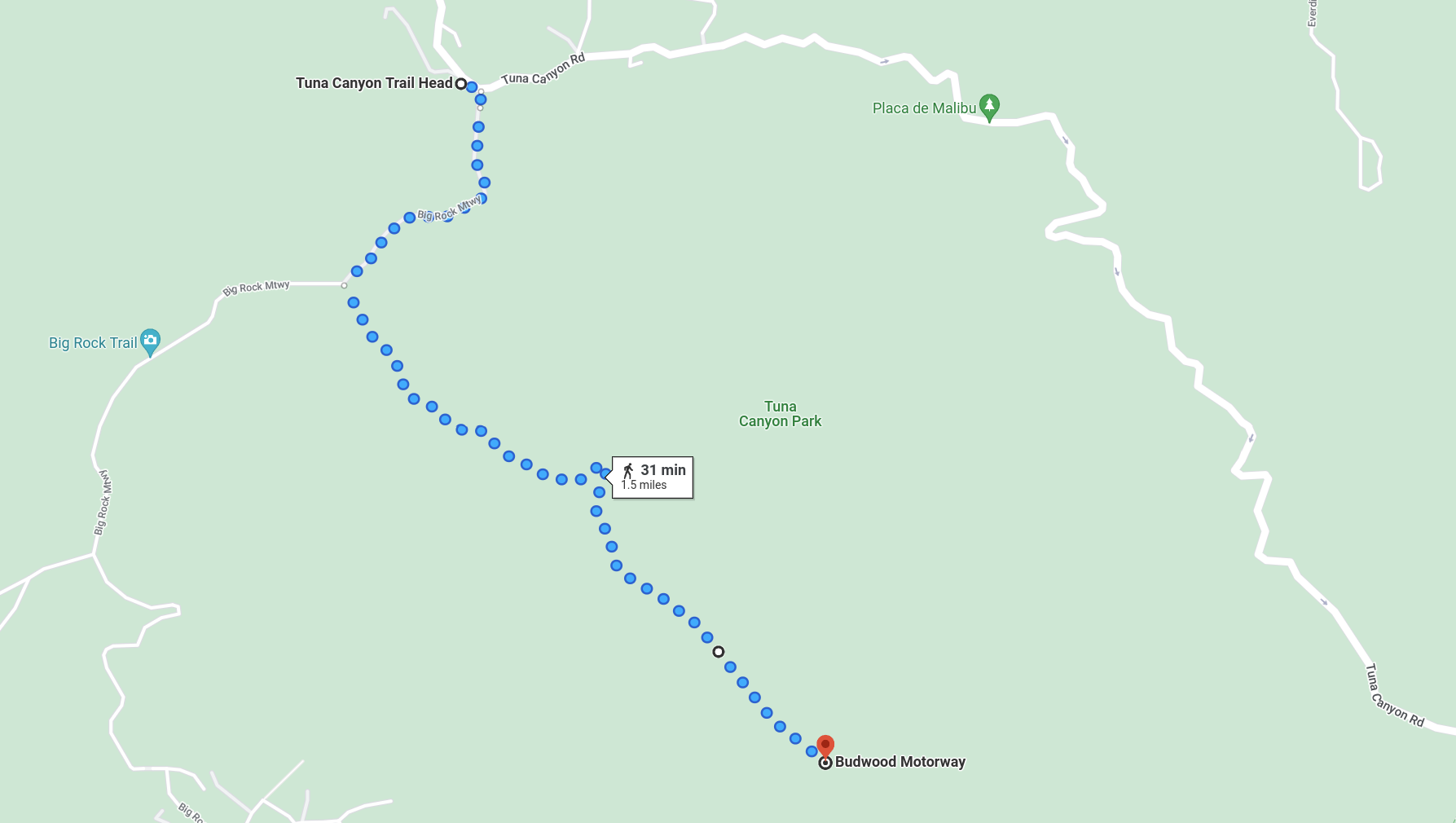
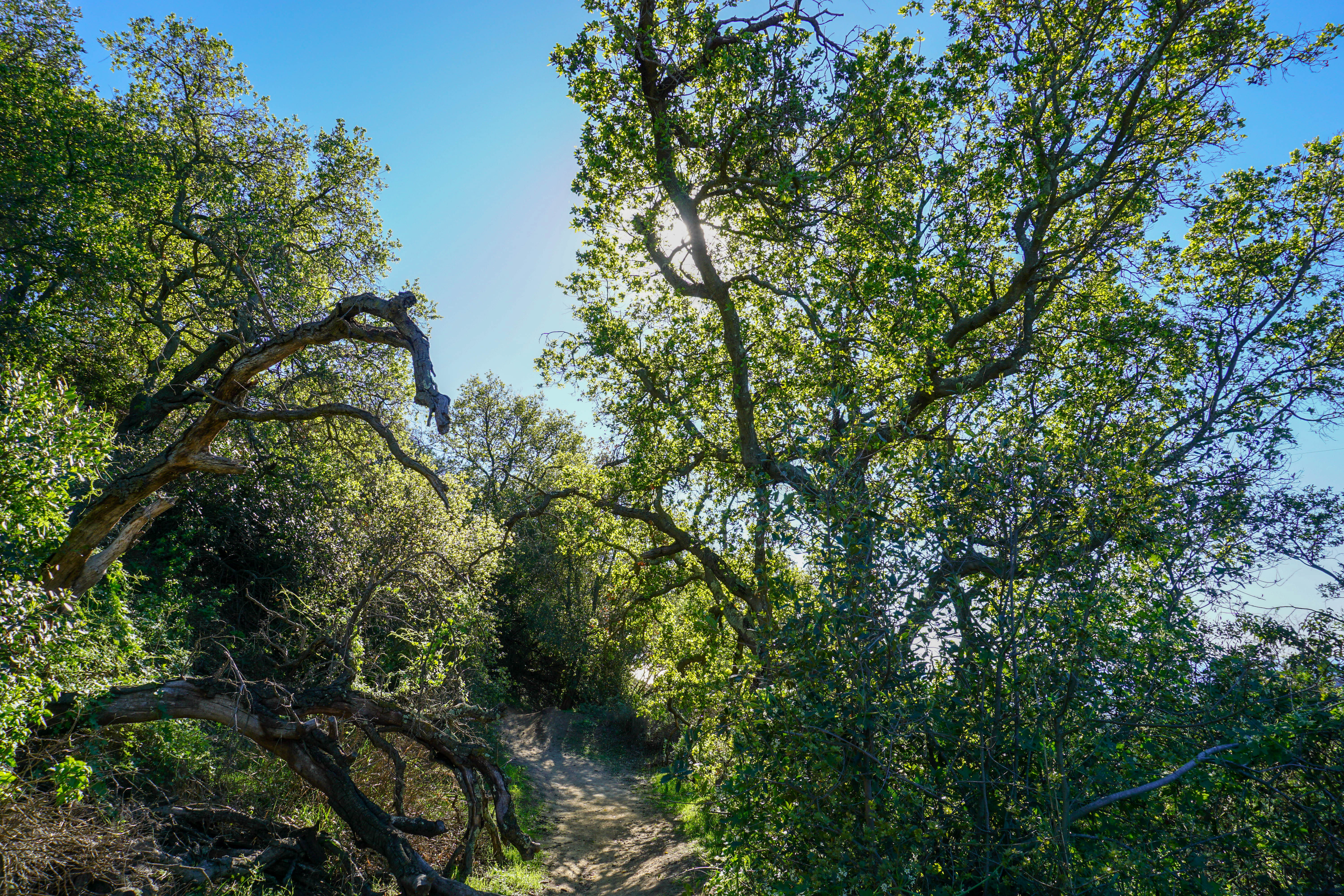
The hike starts close to 3233 Tuna Canyon Rd. You will see cars parked on the right which is where the big rock trail begins. You will first go through some oak tree meadows.
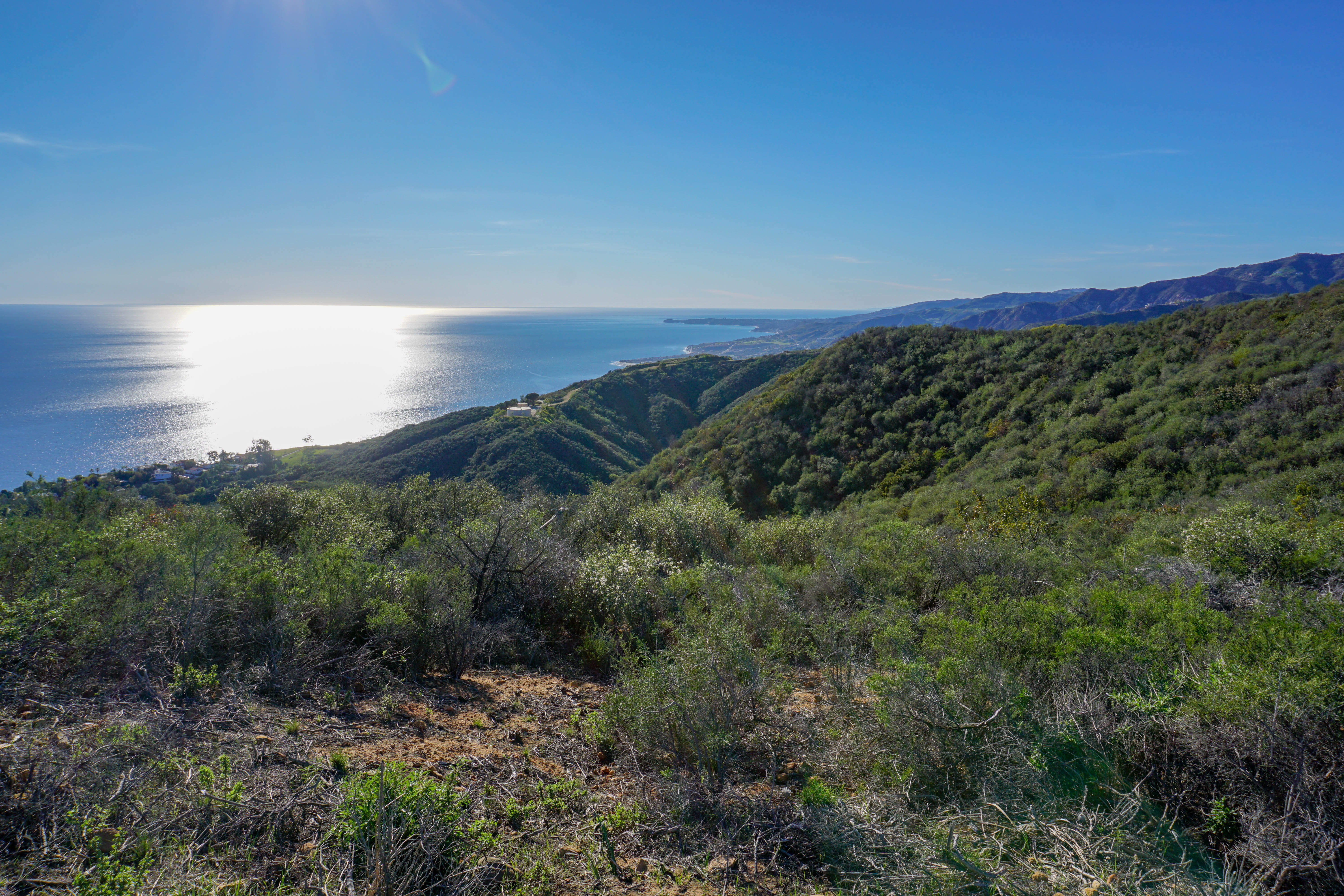
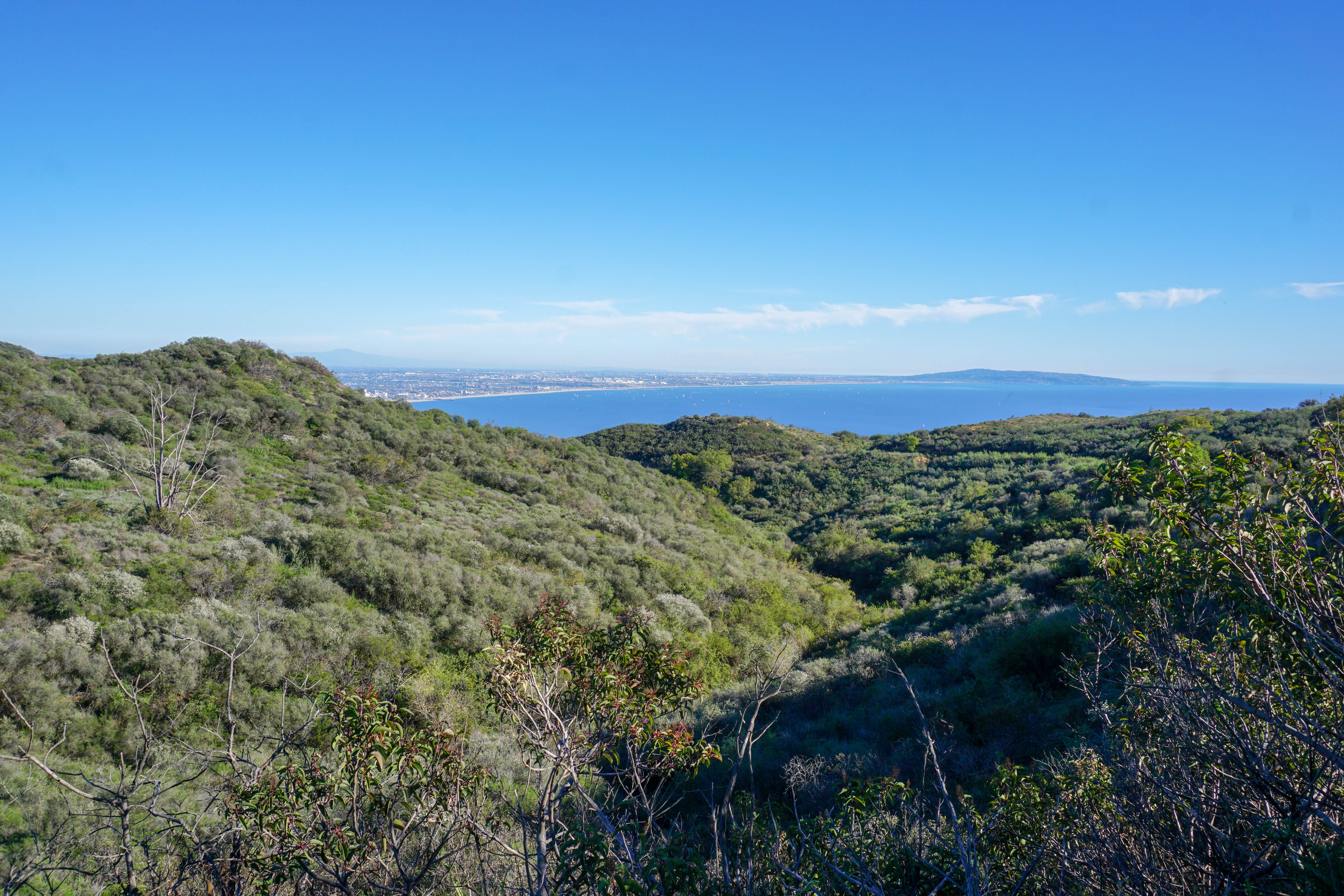
After a few minutes the trail opens up and you are greeted by stunning ocean and mountain panorama. The budwood trail will split from big rock trail, follow it to your left. This is the nicer and more scenic of the two paths.
There are several smaller paths that go left you can take those or decide to stay on the main trail, it all goes to same place. Looking to your right you can see the malibu pier and point dume in the distance. To your left will be the los angeles bay and santa monica.
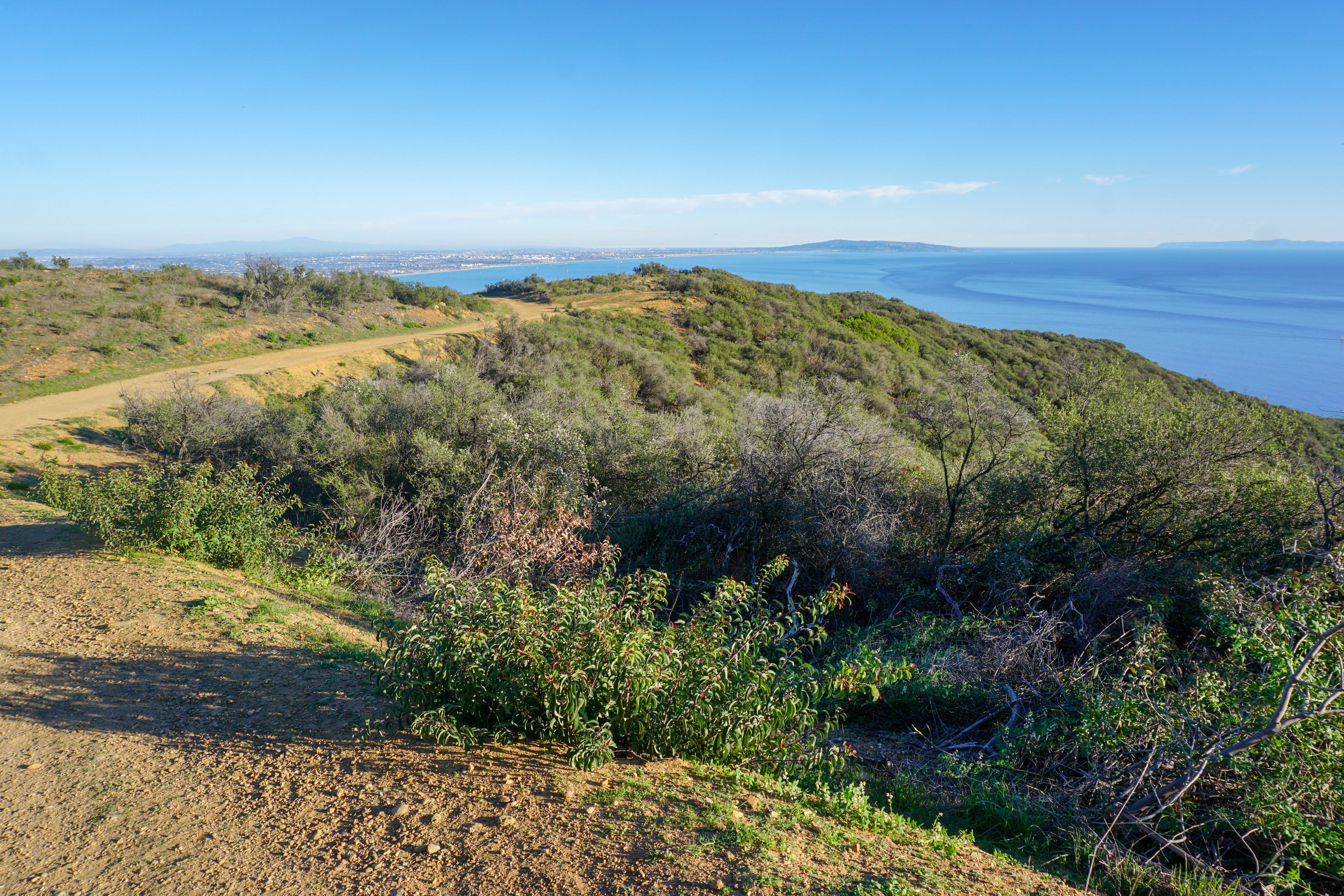
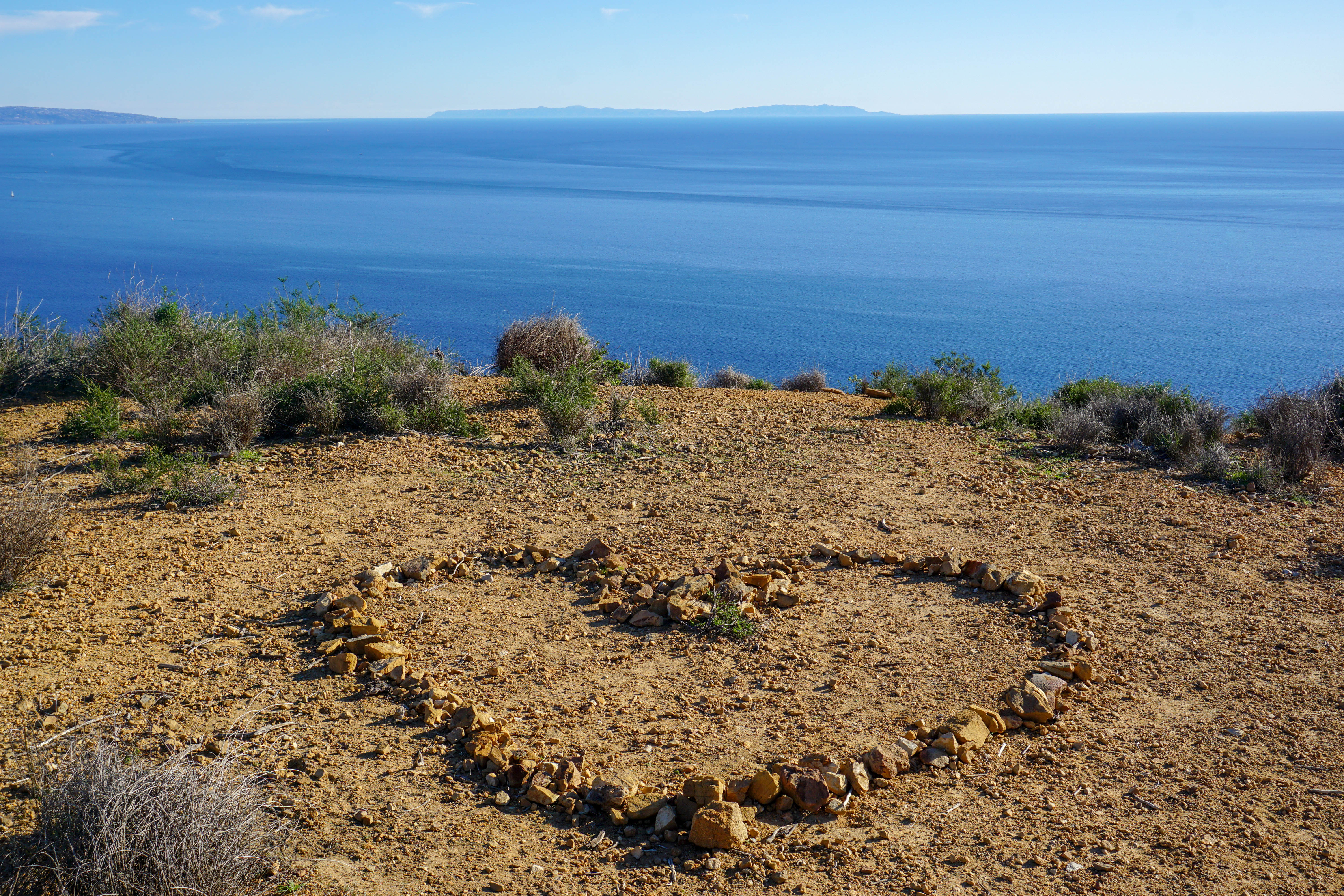
After about 45 minutes you reach the end of the trail. You will see a heart, made of rocks with a breathtaking view of catalina island.
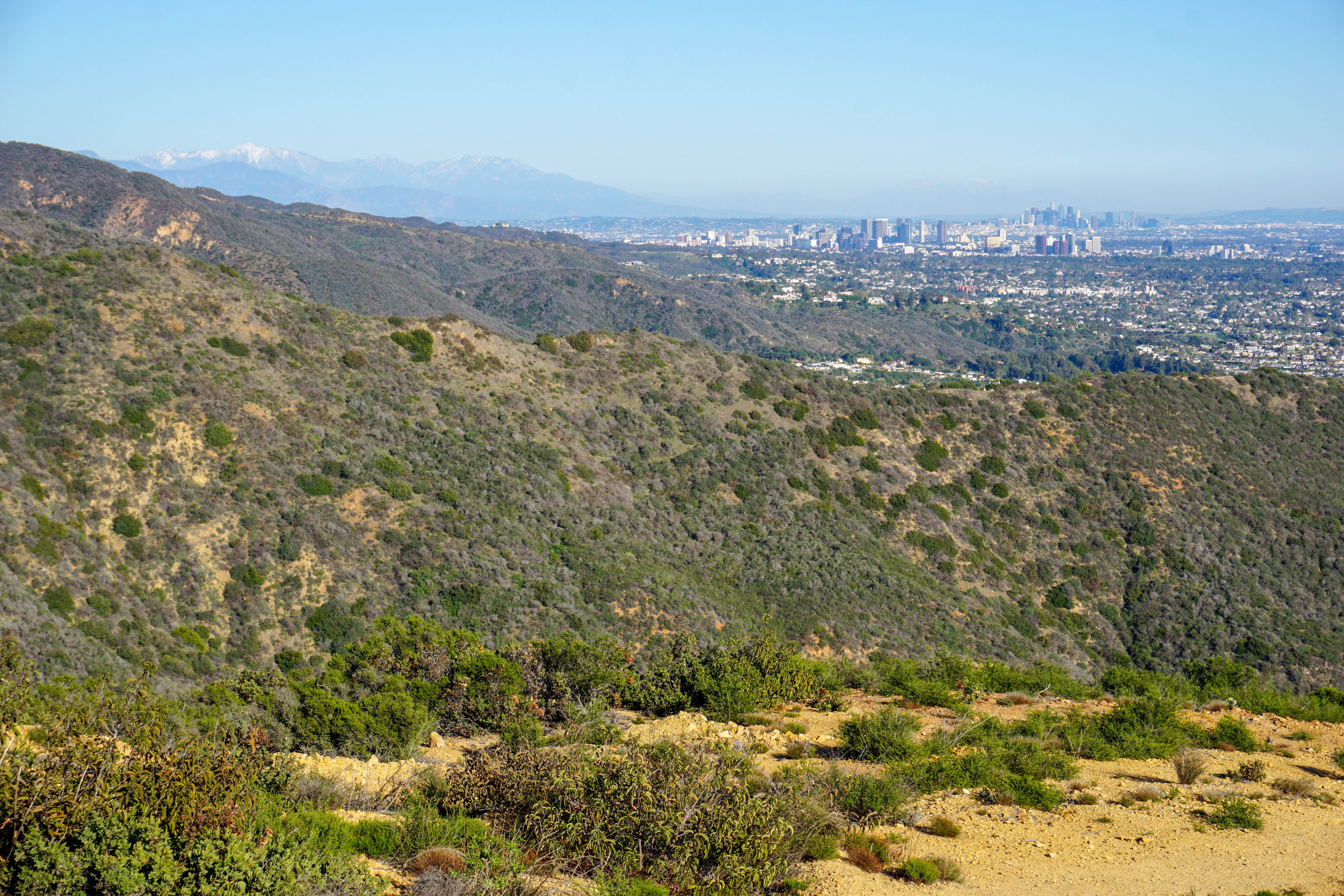
To your left you can see culver city and beyond it, downtown LA. On a really clear winter day you can see a snow capped mount baldly in the far distance.
When you are ready to go back take the same trail but stay on main trail this time to your left. If you took the side trails on way down then most of way back will be different which makes the hike even more enjoyable. Once you get back to big rock trail go right. After you are back in the car continue on tuna canyon road, stay to your right and take the one way road down tuna canyon to PCH. It is an amazing drive and one few people get to experience.
1
2
3
4
Activity: Hiking
Duration: 1.5 hours
Difficulty: Easy
Bring: Good shoes, hat, water and snacks